

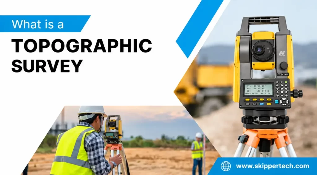
A topographic survey is one of the most important types of surveys in construction, infrastructure, engineering, architecture and land development. Before any building, road, highway, bridge, drainage system or any other development project is undertaken, it is important to know the actual conditions of the land. Topographic surveys give exact information regarding the elevation, contours, slopes, natural features and man-made structures on a site.
A simple boundary survey will show property lines, while a topographic survey will give a detailed representation of the physical features of the land. Surveyors collect field measurements using modern equipment such as Total station, auto level, Sokkia auto level, robotic total station and theodolite.
This information can be used to generate detailed drawings and contour maps, digital site plans and 3D models which help engineers and architects make better decisions.
In this guide, we will talk about what a topographic survey is and how it works, the equipment that is used, its applications, benefits and why accurate land surveying is important for modern construction and development projects.
What is a topographical survey?
Topographic Survey A topographic survey is a detailed land survey that shows the physical features and elevation changes of a specific area.
It shows how both do:
- Natural features are hills, slopes, trees, rivers, streams, rocks and terrain.
- Man-made features such as roads, buildings, walls, poles, drainage, utility structures, fences and other construction features.
The data collected is then used to create a map or digital representation of the site.
Elevation is one of the most important elements of a topographic survey. Height measurements are used by surveyors to find the relative heights or depths of certain points above or below a chosen reference level.
For example, if a proposed building location has a significant slope, engineers need precise elevation data to determine how much excavation is needed, what the foundation height should be, how to set up drainage, and how to plan grading.
Why is topographic survey important ?
Accurate site information is the foundation for successful construction and development. In the absence of dependable survey data, engineers may have to make assumptions about terrain and site conditions.
A topographic survey helps to reduce these uncertainties.
1.Proper Site Planning
Architects and engineers are able to be aware of the conditions of the land before they start a design. This enables the proposed structure to be designed according to the actual site.
2.The Significance of Elevation and Slopes
Elevation data is important to find the natural slope of the site. This is particularly relevant for roads, drainage systems, buildings and infrastructure projects.
3.Reduce Errors During Construction
Accurate measurements reduce errors in the planning, design, excavation, grading and construction.
4.Improved Drainage Planning
Water flows downhill naturally. Topographic data helps engineers design effective drainage systems and identify areas that may be prone to water accumulation.
5.Earthwork estimation
Elevation and contour data can be used to estimate the amount of excavation and fill. This can help project teams plan material movement and manage costs.
6.Engineering Design Support
Civil engineers need accurate terrain information for the design of roads, highways, bridges, retaining walls, utilities and other infrastructure.
Topographical Survey vs Land Surveying
Land surveying is a broad field consisting of several types of surveys performed to measure and document land. Topographic surveying is one such specialized application.
Land surveying may involve:
- Boundary Surveying
- Surveying (General)
- Construction Surveying
- Surveys of routes
- Cadastral Survey
- Surveys in Engineering
- As built surveys
- Hydrographic surveys
A boundary survey is mostly concerned with the location of property lines, whereas a topographic survey is concerned with the physical features and elevations of the land.
Many construction projects will use both of these surveys together to provide the full picture of the site.
What Information Is Contained in a Topographic Survey?
The exact information collected will depend on the project’s needs and the site conditions. A typical survey may contain:
- Increase of ground
- lines of contour
- Spot prices
- Roads & Pathways
- Buildings and constructions
- Boundary characteristics
- Trees and vegetation
- Telephone poles.
- Drainage canals
- Manholes
- Fences and walls
- Bodies of water
- Slopes
- Current infrastructure
- Other visible features of site
The survey data can be shown as a 2D drawing, digital map, CAD plan, GIS dataset or 3D terrain model.
Equipment Used for Topographic Survey
The modern surveyors use a combination of conventional and modern instruments of surveying. Selection of equipment depends on accuracy requirements, terrain, size of site and complexity of the project.
Total Station
A total station is one of the most widely used instruments for modern surveying.
It merges electronic angle measurement with distance measurement and data logging. Surveyors measure horizontal angles , vertical angles , slopes , and distances between points .
A Total station can be used to collect co-ordinates of points all over a site. The measurements can then be downloaded into surveying software for mapping and drafting.
Total stations are widely used for:
- Topographical surveys
- Construction layout
- Boundary surveys
- Road surveys 18.
- Building inspections
- Surveys as built
- Engineering Surveying
Today, total stations remain an essential component of land surveying because of their accuracy and versatility.
Auto Level
An auto level is mainly used to establish differences in elevation between points.
An auto level is a very useful instrument for leveling work as against instruments that are primarily used for measuring angles and distances.
Typical uses are:
- Setting of elevations
- Transfers at the benchmark level
- Roads & construction
- Construction of buildings
- Drainage work —
- Basement
- Earthwork Computation
An auto level can be a vital tool for projects where accurate elevation information is important.
Sokkia Auto Level
The Sokkia auto level is a surveying level for accurate leveling work. Sokkia instruments are often used in survey and construction applications where accuracy in elevation measurements is required.
A Sokkia auto level can perform the following tasks:
- Differential Leveling
- Reference elevations established
- Construction level verification
- Roads and Infrastructure projects
- Validation at foundation level
- Excavation and grading work
The selection of leveling equipment depends on the accuracy required, the specifications of the project and the field conditions.
Robotic Total Station
A robotic total station is an advanced form of Total station that is capable of automatically tracking a prism or target and can often be operated remotely by a single surveyor.
This can make you more productive on projects where you have to measure a lot of points.
Robotic total stations can be helpful for:
- Large construction sites,
- The building’s layout
- Operations of machine control
- Surveillance
- Structural work
- Detailed topography data collection
Their automation could decrease the need for multiple field personnel in some surveying workflows and help improve field efficiency.
Theodolite
The theodolite is a surveying instrument primarily used for measuring horizontal and vertical angles.
Traditionally it has been used for:
- Measuring an angle
- Alignments
- Survey Traversing
- Construction surveys
- Survey control
Though the modern Total station combines several surveying functions into one instrument, the theodolite still remains an important instrument in the history and fundamentals of surveying.
It’s also helpful to survey professionals to understand how a theodolite works because angle measurement is a fundamental part of many surveying methods.
How Is a Topographic Survey Done?
The exact workflow will differ from project to project but a typical topographic survey generally consists of a few stages.
Step 1: Planning the project
Prior to going onto the site the survey team considers the project requirements and decides what information needs to be collected.
This can include:
- Site Limits
- Precision required
- Coordinate scheme
- Reference elevation
- Existing buildings
- Contours range
- Required Outputs
Proper planning ensures that the field team gathers the correct data.
Step 2: Configure Survey Controls
Survey control points give a reliable framework to reference the survey .
Known horizontal coordinates and elevations can be added as control points. These points help ensure that all measurements taken are correctly positioned.
Step 3: Site recon
The survey team visits the site to identify key features and determine the best locations to set up surveying gear.
While performing reconnaissance, surveyors can find:
- method of entry
- Current structures
- Challenges
- Flora
- Features of utility
- Terrain variations
- Current standard
Step 4: Collecting Data in the Field
The survey crew starts to take measurements with the appropriate equipment.
Total station or robotic total station can measure coordinates and detailed site features. For precise elevation work use Sokkia auto level or auto level.
Surveyors take points all over the site to represent the terrain and significant objects.
Step 5: Record Elevation Point
Elevation data is one of the most critical components of a topographic survey.
Surveyors take spot levels at selected points. You might need more points where the terrain changes rapidly.
For example, a flat surface may need fewer elevation points than a steep or irregular landscape.
Step 6: Processing of data
After field collection survey data is transferred into surveying software or CAD software.
The collected coordinates and elevations are reduced to yield:
- Contour lines
- Digital elevation models
- Site plans
- Levels on spot
- 3D surface terrain
- Survey drawings
Step 7: Creating the Final Survey
The final survey drawing is presented in a format that shows the measured features and terrain information for engineers, architects, contractors and project managers.
Deliverables may include CAD files, PDF drawings, coordinate data or digital terrain models depending on the project.
What Are Contour Lines?
A topographic map has contour lines, which is an important feature.
A contour line connects all points of equal elevation. Engineers and surveyors use contour lines to tell the shape and slope of the land.
For example:
- Contours that are close together usually mean a steep slope.
- Wide spaced contours are usually a more gentle slope.
- Contours that are almost parallel indicate a relatively uniform slope.
- Changes in the contour pattern may be ridges, valleys, depressions, or other terrain features.
Contour information is very useful in site planning and engineering design.
Uses of Topographical Survey
Topographic surveying is used in a wide range of industries.
Construction
Before constructing any structure, the existing ground conditions must be understood. Survey data allows engineers to determine site grading, foundation levels, drainage needs and earthwork.
Road & Highway Projects
Terrain and height are the parameters which have a strong influence on the design of roads. Topographic data assists engineers in designing road alignment, slopes, drainage, intersections and earthwork.
Building Bridges
Bridge projects require accurate information about ground levels, riverbanks, roads and surrounding terrain.
Real estate development
Developers are able to use topographic information to evaluate development opportunities, drainage, grading, access, and site limitations.
City Planning
Cities and planners need terrain data to plan infrastructure, utilities, roads, stormwater management and development projects.
Drainage and Stormwater Projects
Elevation information is needed to understand how water moves across the site and how to design drainage systems.
Mining
Mining projects are often large and complex terrain. Survey data can be used for planning, volume calculations, site monitoring and development.
Environment Projects
Topographic information is useful for environmental assessments, watershed studies, landscape planning and site restoration.
Benefits of Using Modern Surveying Equipment
Modern instruments have made surveying more efficient and more accurate.
There are several benefits associated with employing equipment like a Total station, robotic total station and digital leveling systems.
Greater Precision
If calibrated and used properly, electronic measuring equipment can provide accurate measurements.
More data, more quickly
Modern instruments permit the surveyor to gather and record many points quickly.
Digital information
Survey information can be moved directly into digital workflows, reducing manual data entry.
Improved Visualization
Survey data can be transformed into digital maps, contour drawings and 3D models.
Better Project Collaboration
Digital survey files are available to share with architects, engineers, contractors and other project participants.
Factors Influencing Accuracy of Topographic Surveys
A survey’s accuracy depends on a number of factors.
Calibration of Equipment
Survey instruments shall be properly maintained and checked for calibrations in accordance with manufacturer and project requirements.
Surveyor Competence
The surveyor’s experience and technique are critical in the collection of reliable data.
Forecast
Field operations may be affected by environmental conditions such as rain, extreme heat, dust, visibility issues and others.
Accessibility of the site
Some points can be difficult to measure because of buildings, vegetation, traffic, water bodies and other obstacles.
Control Points
Wrong or badly established control points can influence the accuracy of the whole survey.
Data Processing
Even with accurate measurements in the field, incorrect processing of the data can result in incorrect results.
How Often Is a Topographic Survey Required?
There is no timeline for a topographic survey to be redone.
When a new survey might be necessary:
- The earth has moved.
- Building has changed the site.
- New development is scheduled.
- Survey information is out of date at present.
- New roads or utilities have been put in.
- Earthwork has altered site elevations.
- Project design requirements have evolved.
For large construction projects, updated surveys may be performed at different points during construction.
Topographic Survey for Building Projects
A topographic survey can be an important first step in construction projects.
Engineers need to understand the existing condition of the site before designing. A detailed survey can provide the information needed to design the project for the real conditions of the site—not just assumptions.
For example, consider a proposed building site on an uneven slope. The survey data can be used to determine:
- Current ground levels
- Proposed elevation of building
- Cut and fill required
- Road access levels
- Drainage direction
- Considerations for the foundation
- Infrastructure in the vicinity
This information may improve planning and coordination between design and construction teams.
Auto Level vs Theodolite vs Total Station – Difference Between
While these instruments are often grouped together, they have different primary purposes.
Total Station: Measures angles & distances, can calculate/store co-ordinates.
Auto Level: Commonly used to find differences in elevation and transfer of levels.
Sokkia Auto Level: An auto level used for accurate leveling jobs.
Robotic Total Station: An automated Total station capable of tracking targets and facilitating remote or one-person surveying workflows.
Theodolite: a device that measures horizontal and vertical angles.
The instrument to be used depends on the survey task, required accuracy, size of the project and site conditions.
Why is Accurate Land Surveying Important?
Good information makes for good project decisions.
Engineers, architects, developers and contractors can understand the physical attributes of a site with precise land surveying before making important design and construction decisions.
A topographic survey is one part of this wider surveying process that records terrain, elevations, contours and existing features.
When properly controlled, accurately measured in the field, well processed and skillfully surveyed, survey information can be a valuable foundation for successful project planning.
Conclusion
A topographic survey is a detailed map of the shape, elevation, slope and physical features of a tract of land. It is very important for construction, infrastructure, road development, drainage planning, real estate development and other engineering projects.
Survey professionals use modern equipment such as the Total station, auto level, Sokkia auto level, robotic total station, and theodolite to collect accurate field information for a wide range of applications.
It is important to understand the existing terrain before design and construction commences, whether the project is a small building site or a large infrastructure project.
By combining accurate land surveying methods with modern digital workflows, project teams can produce reliable site plans, contour maps, elevation models and other engineering outputs needed for successful planning and execution.
On any project where terrain, elevation and existing site features are important, a properly done topographic survey can provide the critical data needed to move from site investigation to informed engineering and construction planning.