

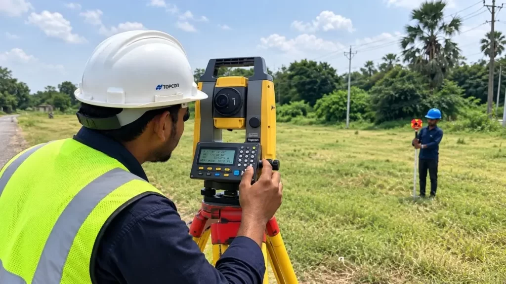
Land surveying is among the most crucial processes in construction, infrastructure development, real estate, mapping and land management. It helps to know the exact position, borders, heights, size and characteristics of a tract of land. It is important to do accurate surveying before starting a construction project. Even a small measurement error can lead to expensive mistakes.
Land surveying today is a combination of traditional field surveying techniques and sophisticated tools such as Total Stations, GNSS surveying equipment, Auto Levels, Digital Levels, and 3D Laser Scanners. Surveyors can use these technologies to take very accurate measurements and to build detailed maps and models of their survey area.
Accurate land measurement forms the basis for the success of any planning and construction project whether it is for a residential building, highway, railroad, bridge, commercial development or a large infrastructure project.
In this guide, we will explain what land surveying is, how it works, different types of land surveying, surveying methods, equipment used, applications, advantages and how modern technology has changed the surveying industry.
What Is Land Surveying?
Land surveying is a scientific activity through which the location of points, distances, angles, elevations, and boundaries on or near the earth’s surface are determined.
A land surveyor is an expert who takes field measurements using special equipment and then uses the data collected to produce various types of plans, drawings, maps, and coordinates.
The primary reason why people undertake land surveying is to obtain information that would help stakeholders such as engineers, architects, contractors, developers, and property owners make good decisions regarding a certain piece of land.
During the process of land surveying, it is possible to find out the following information before designing or developing a piece of land:
- Boundaries of the land
- Elevations of the land
- Existing buildings
- Roads and utilities
- Contours and slopes
- Positions of important points
- Coordinates of important points
Why Is Land Surveying Important?
Land surveying is an integral part of almost all major construction and development projects. Poor survey data can cause construction crews to build in the wrong place, over property lines or work with the wrong elevations.
1.Locating Property Corners
One of the most common reasons for land surveying is determining property boundaries. A boundary survey will identify the legal limits of a property and can help prevent disputes between neighboring property owners.
2.Planning the Construction
Before construction begins engineers need the correct information about the land. Surveying provides project planning with the coordinates, elevations, slopes and other information it needs.
3.Proper Building Layout
Surveyors measure accurately to locate foundations, columns, roads, drainage systems and other structures shown on engineering drawings.
4.Hazard identification and mapping
Elevation measurements are important for roads, drainage, bridges, pipelines, buildings and other infrastructure. Wrong elevation can cause drainage problems and affects structural construction.
5.Land Development and Charting
The survey data can be used to produce detailed maps of natural and man made features. The maps are used for land development and engineering design.
6.Prevention of Construction Errors
Precise measurements reduce risk of expensive mistakes during construction. A reliable survey makes it possible to work according to the approved design.
How Does Land Surveying Work?
The exact workflow will differ from project to project, but a typical land surveying process will include several important steps.
1.Learning and preparation
Surveyors will look at the information available before they go out to site such as:
- Existing plans
- Property records
- Historical survey data
- Project drawings
- Control points Coordinate systems
This allows the survey team to understand the project’s needs.
2.Setting Up Control Points
Surveyors made sure to set up dependable reference points around the site. These control points form the basis for gathering and transferring measurements.
Modern GNSS instruments and Total Stations allow to establish coordinates with very high accuracy.
3.Field Data Gathering
The survey team visits the site and measures the required points using appropriate surveying equipment.
Measurements may include: depending upon the project:
- Horizontal angles
- Vertical Angle
- Coordinates of Distances
- Altitudes
- Ground features.
4.Data Processing
Data collected in the field are imported into surveying software for processing and analysis. Surveyors can compute coordinates, elevations, distances, areas and other project information.
5.Drafting and Cartography
Then the processed information can be used to produce:
- Topographical maps
- border plans
- Contour plots
- Site Plan
- Layout for Construction
- Digital terrain models 3D models.
6.Confirmation
The data collected is checked for errors . Measurements are verified by professional surveyors . The final survey results are delivered .
Types of Land Surveying
There are different types of land surveying, and the right type depends on the purpose of the project.
1.Surveying of Boundaries
A boundary survey determines the legal boundaries of a property.
Often it is necessary for:
- Real estate buying
- Property development
- Land subdivision Fencing Legal disputes
- Building near property lines
Boundary surveys involve more than just field measurements; they also involve the careful review of legal records and physical evidence.
2.Topographic Survey
A topographic survey gathers data of the natural and man-made features of a site.
May include:
- Buildings Roads Trees Drainage Utility structures
- Elevations of ground
- Slopes Contour
Topographic surveys are especially helpful for engineering and construction planning.
3.Surveying for Construction
Construction surveying provides the measurements and layout information required during construction.
Surveyors can mark:
- Corners of buildings
- Locations of Foundations
- Column Pos.
- alignments of roads
- drainage channels
- Utility locations
- Structure parts
Construction surveying helps contractors build engineering plans.
4.Cadastral Surveying
Cadastral surveying is about land ownership, parcel boundaries and property records. It is usually associated with legal land administration and property management.
5.Engineering Surveying
Engineering survey is used in infrastructure projects such as:
Highways Bridges Railroads Dams Tunnels Industrial facilities
It provides accurate measurements that are needed for engineering design and construction.
6.ROUTE SURVEYS
Linear infrastructure like highways, railroads, pipelines, canals and transmission lines are all surveyed using route surveying.
The survey team establishes alignment, profile, elevations and features along the proposed route.
7.As-Built Survey
An as-built survey documents the actual position and elevation of elements built during or after construction.
It assists project teams to verify that the completed work is in accordance with the approved design.
8.Hydrographic Surveys
Hydrographic surveying measures areas under water, such as rivers, lakes, reservoirs, harbors, and coastal waters.
Equipment that is specialized, like echo sounders and marine positioning systems, may be used.
Methods Used in Land Surveying
Modern surveyors use several methods depending on the accuracy needed for the project, terrain, and size and output required.
Surveying in Chains
One of the simplest of the traditional methods of surveying is chain surveying. It is mainly linear measurements and is suitable for small and relatively simple areas.
Chain surveying has been replaced by modern technology for many professional applications, but it can still be useful for basic measurements.
Compass Surveying
Compass surveying is the use of Compass to find directions and angles and combining them with distance measurements.
Useful for basic surveying applications, but generally not as accurate as modern electronic equipment.
Plane Table Survey
Plane table surveying is a technique by which the surveyors can see and plot information in the field directly. This can be useful for some mapping applications.
Levelling
Leveling is the process of determining the differences in height between points.
Topcon Auto Level or digital level is used for accurate elevation measurements for construction and engineering applications.
Total station survey
Total Station. Electronic measurement of angles, with distance measurement and coordinate calculation.
It is used extensively for :
- Layout of construction
- Topographical surveys
- Survey of building
- Road projects
- Boundary surveys
- Alignment Tasks Supervision
Today’s Total Station can boost the productivity of the field by allowing surveyors to collect and manage large volumes of accurate coordinate data.
Surveying with GNSS
GNSS surveying involves the use of satellite positioning systems to determine the precise coordinates of points.
GNSS receivers are particularly valuable for:
- Big construction sites
- Topographic maps
- Surveys for Control
- Infrastructure works
- Cadastral Surveys 1.
- GIS Data Collection –
In suitable situations, GNSS technology can reduce the number of conventional line-of-sight measurements.
Laser Scanning 3D
3D laser scanners collect huge amounts of spatial information and can produce detailed point clouds.
This technology may be used to:
- Documentation building
- industrial facilities
- Infrastructure :
- As-built surveys
- Heritage documentation
- Complex structures.
Equipment Used in Land Surveying
Proper equipment is required for accurate land surveying. The choice is a function of project size, required accuracy, terrain, and the deliverables of the project.
Total Station
Total Station is one of the most widely used modern surveying instruments .
It measures angles and distances and can find points coordinates. Total Stations are used extensively in construction, engineering, topographic surveys and layout jobs.
Topcon Total Station equipment is made for applications that need accurate measurement and reliable field performance.
Auto Level
An Auto Level is used mostly to determine elevation differences.
It is widely used for:
- Road work
- Construction of buildings
- Drainage works
- Work on the foundation.
- Earthwork General leveling Leveling instrument
Digital Level
Digital Levels provide electronic measurement and can enhance field productivity and data recording over traditional optical leveling workflows.
GNSS Receiver
GNSS receivers use signals from satellites to calculate very precise positions. Depending on the system and correction method, survey-grade GNSS can deliver very accurate positioning.
3D Laser Scanner
A 3D laser scanner densely measures space to produce detailed point clouds and 3D representations of the environment being scanned.
Accessories for Survey
Surveyors also use a number of accessories such as:
- Tripods.
- Pole surveys
- Prisms
- Prism pole
- Batteries
- Data gatherers
- Measuring tape
- Measuring instruments
Use of the right accessories is important to getting repeatable field results.
Land Surveying Using Total Station
One of the most common methods of modern land surveying is with a Total Station.
A typical Total Station survey workflow is to place the instrument over a known point, level and orient the instrument, establish a reference direction and measure target points.
Such data are calculated or recorded by the instrument as:
- Angle horizontal.
- Vertical elevation
- Slope distance Horizontal distance Elevation Coordinates
The data collected can then be uploaded into survey software for further processing.
Total Stations are particularly useful when a project needs accurate positioning and direct measurement between the instrument and the target.
Land Surveying with GNSS
The importance of GNSS surveying has increased for large-scale mapping and infrastructure projects.
GNSS receivers compute position using signals from satellite navigation systems. Surveyors can achieve much higher accuracy with correction services and base-rover workflows than with ordinary consumer GPS devices.
GNSS is especially helpful when you are surveying:
- Large open spaces
- Roads & highways
- Agricultural Lands
- Powerlines
- Large building sites
- Mapping projects and
However, the performance of GNSS can be degraded by obstacles such as tall buildings, dense vegetation and other conditions affecting satellite visibility.
Applications of Land Surveying
Land surveying has many uses across many different industries.
Construction
Surveyors assist construction projects from the initial site investigations to the final as-built measurements.
Roads & Highways
Accurate alignment, elevation, cross sections and earthwork measurements are essential for road projects.
Bridges
Accurate positioning and elevation control is required for the foundation, pier, deck and structural components in bridge construction.
Real Estate
Property surveys identify boundaries, dimensions and site conditions.
City Planning
Land planning, infrastructure, utilities and city growth are aided by surveying.
Mining
Mine planning, volume calculations, stockpile measurements and monitoring are done by surveying.
Agricultural
Modern GNSS surveying and positioning technologies can support precision agriculture, land management and field mapping.
Utilities
Surveying maps of utility infrastructure such as pipelines, electrical networks and drainage systems.
Advantages of Modern Land Surveying
Modern methods have made survey work a lot quicker and more accurate.
More precise
Used correctly, electronic and satellite-based instruments give measurements of very high precision.
Speedier Data Gathering
With digital instruments surveyors can collect large numbers of points very efficiently.
Improved Data Management
Data can be downloaded into specialized software for processing and analysis.
Fewer Human Mistakes
Automating calculations and electronically recording data can help reduce manual calculation errors.
Increased Efficiency
Modern instruments, coupled with integrated workflows, allow survey teams to complete many projects in less time.
3D Data and Visualization
For more complex projects, laser scanning and advanced surveying technologies can be used to produce detailed 3D datasets.
Challenges in Land Surveying
Modern equipment has improved the art of surveying enormously but surveyors still have a number of problems to face.
Hard Terrain
Measurements in the field can be difficult on steep slopes, mountains, vegetation and rough ground.
Weather
Rain, heat, dust and poor visibility can affect field operations and equipment performance.
Satellite Obstruction
GNSS surveying can be difficult in dense vegetation in urban areas, or near buildings that block satellite signals.
Instrument Configuration
Improper setup, calibration or handling may affect measurement accuracy.
Errors in Data
Wrong final outputs may occur due to problems with field coding, data transfer and poor quality observations.
Therefore, proper survey procedures, calibration of the equipment, field checks and professional expertise are essential.
How to Choose the Right Land Surveying Equipment
The Best Surveying Equipment Depends on Your Project Requirements
Think about this:
Project Type
Decide if you require equipment for construction, topographic mapping, boundary work, roads, infrastructure, or other application.
Precision Required
The accuracy required will differ from project to project. Choose equipment that will satisfy the required tolerance.
Site Conditions
Take terrain, vegetation, buildings, GNSS availability and line of sight conditions into account.
Data Collection Requirements
If your project requires high volume digital field data, consider equipment with integrated data collection and software workflow support.
Money
Surveying equipment can be as simple as a level or as sophisticated as robotic total station and GNSS equipment. Select technology based on real project requirements and not on extra features you don’t need.
Support and Service
When selecting professional surveying equipment, important considerations are after-sales service, calibration, technical support, training, spare parts and service availability.
Role of Surveyors in Construction Projects
Technology counts, but we still need skilled surveyors.
A professional surveyor will know:
- Principles of measurement
- Coordinate systems
- Surveying process
- Use of Equipment
- Detecting errors
- Processing of data
- Construction drawings
- Field conditions
Surveyors must ensure that the information gathered is reliable and is appropriate to the purpose for which the project is being conducted.
Even the best equipment cannot replace good field procedures and professional judgment.
Land Surveying vs GPS
One often asked question is if land surveying is the same as GPS.
It’s different.
GPS is a positioning technology . Land surveying is a broader professional measurement process .
GNSS/GPS may be part of a survey workflow, but professional surveying may also incorporate Total Stations, Levels, laser scanners, control networks, existing records, field verification and specialized calculations.
Survey-grade GNSS equipment is very different from the GPS receiver in a smartphone or consumer navigation device for high-accuracy applications.
Future of Land Surveying
The profession of surveying continues to change rapidly.
New technologies are accelerating and connecting data gathering. Some important trends are:
- Total Stations – Robotic
- RTK GNSS
- 3D laser scanning
- Drone and UAV surveying
- Light Detection and Ranging – Lidar
- Survey data on the cloud
- Digital twins
- Building Information Modeling (BIM)
- Processing with AI assistance
These technologies can help survey teams collect more information, become more productive, and generate more detailed digital representations of real world environments.
The future of land surveying will likely be more integrated between field instruments, cloud platforms, CAD software, BIM workflows and geospatial technologies.
FAQ About Land Surveying
Land surveying refers to the process of measuring and determining the location, size, boundaries, elevation and physical characteristics of land using surveying tools and professional methods.
Land surveying provides precise data for property lines, building design, cartography, infrastructure projects, land management, and engineering works.
Typical equipment are Total Stations, GNSS receivers, Auto Levels, Digital Levels, 3D Laser Scanners, prisms, tripods, survey poles and data collectors.
Yes. Total Stations are commonly used in land surveying due to their capability of measuring angles and distances and determining the exact locations of points.
GNSS surveying uses satellite navigation system signals to determine accurate geographic positions. Survey-grade GNSS devices are widely used in mapping, control surveys, and construction and infrastructure projects.
Accuracy is a function of the equipment, method of survey, environmental conditions, control network, field procedures, and project requirements. The professional surveyors choose suitable methods and instruments according to the accuracy needed.
Land surveying is a broad term that encompasses many types of surveys. Topographic surveys are used to map the natural and man-made features and elevations of a site.”
Conclusion
Land surveying is the science of measuring and determining locations to plan, design, construct and manage land and infrastructure projects. Good construction and engineering work rely on surveying, from property boundary lines to the layout of complex highways and buildings.
The traditional methods have evolved to modern digital workflows with Total Stations, Sokkia Auto Level GNSS receivers, Auto Levels, Digital Levels, laser scanners and sophisticated surveying software.
Construction companies, engineers, contractors, developers and survey professionals are able to increase accuracy, productivity and project quality by selecting the right equipment and implementing proper survey procedures.
As technologies such as GNSS, robotics, LiDAR, laser scanning, drones and digital mapping continue to develop, land surveying is becoming increasingly efficient and data-driven.
In professional surveying applications, the selection of reliable instruments and the availability of proper technical support, calibration and service are as important as the instrument itself.