

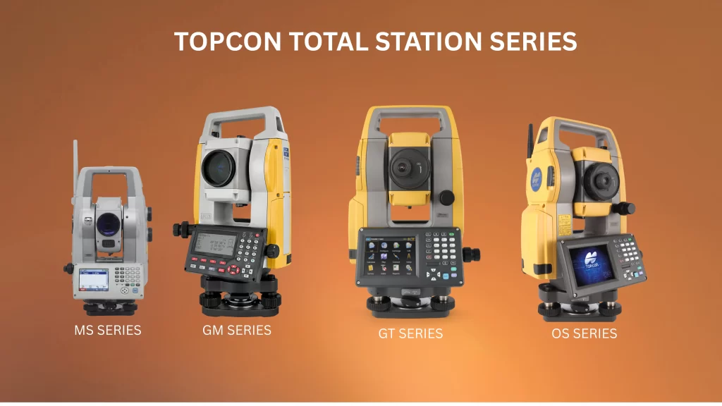
Total Station – The Complete Guide to Precision Surveying
The Total Station is one of the most trusted and used equipment in modern surveying and construction. The Total Station is an electronic theodolite combined with an Electronic Distance Meter (EDM) The instrument allows surveyors to measure angles, distance and elevation with amazing accuracy, all from one instrument.
Whether you’re surveying land, building roads, building layouts or large infrastructure projects, a Total Station allows you to get field work done faster and more accurately than traditional instruments.
In this guide, we will explain everything you need to know about Total Stations, what they are, how they work, the different types, features to look for and how they compare to other surveying equipment like Auto Levels and Digital Levels.
What is a Total Station?
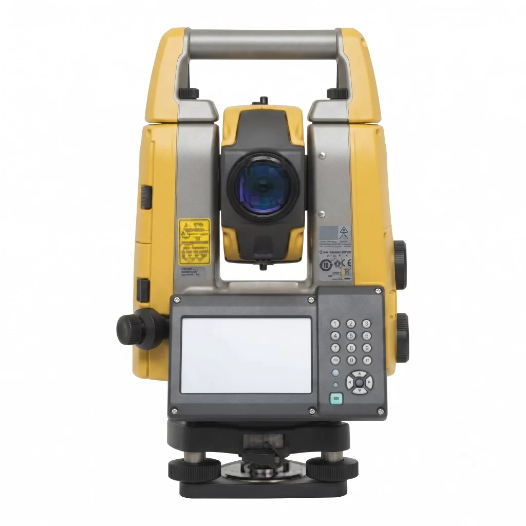
A Total Station is an optical-electronic instrument for measuring horizontal and vertical angles and slope distances from the instrument to a specified point. It employs built-in software to automatically calculate coordinates ( X, Y, Z) and is far more efficient than manual survey methods.
Modern total stations also electronically store data on board and transfer the data directly to computers or survey software such as AutoCAD, Civil 3D or GIS systems for mapping, design and analysis. This is one of the biggest reasons that total stations have replaced older land surveying equipment on most active job sites – the entire workflow from field to office goes digital.
How Does a Total Station Work?
A Total Station works by combining:
- Electronic Theodolite – measures horizontal and vertical angles
- Electronic Distance Meter (EDM) – measures distance using infrared or laser signals
- Onboard Microprocessor – calculates coordinates and stores data automatically
The surveyor points the instrument at a prism or reflectorless target and the Total Station takes the distance, angle and elevation instantaneously and displays the results on its digital display.
Types of Total Station
1. Manual Total Stations
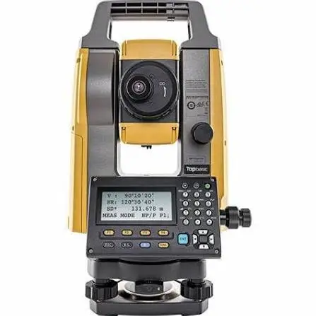
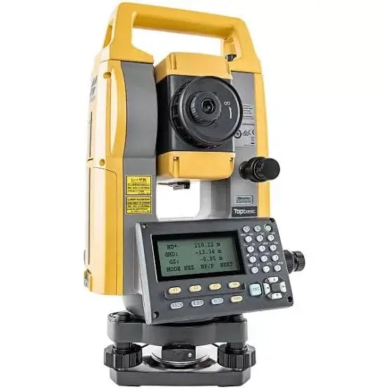
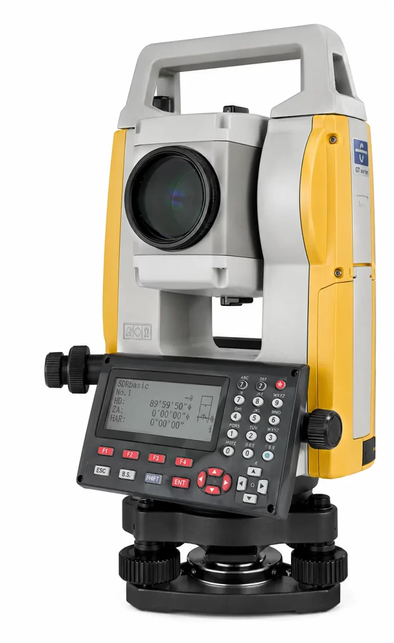
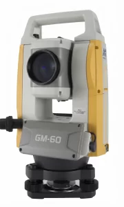
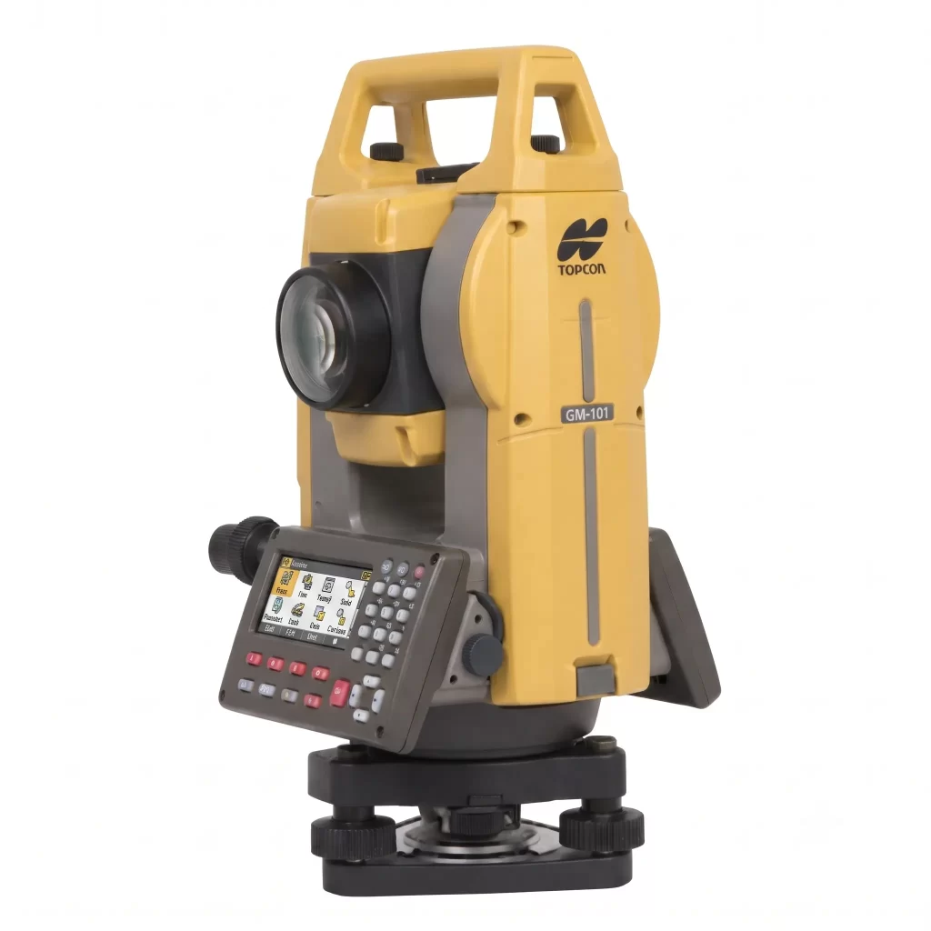
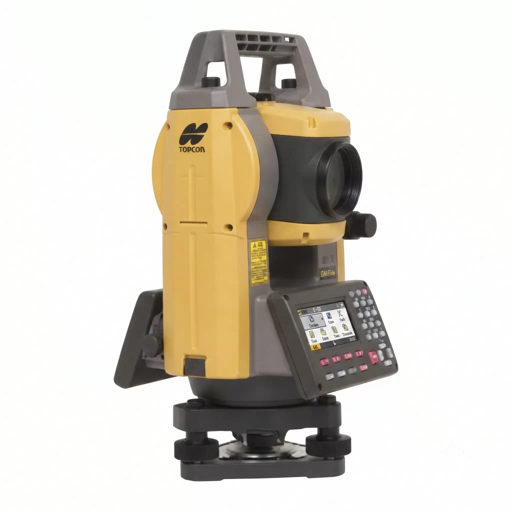
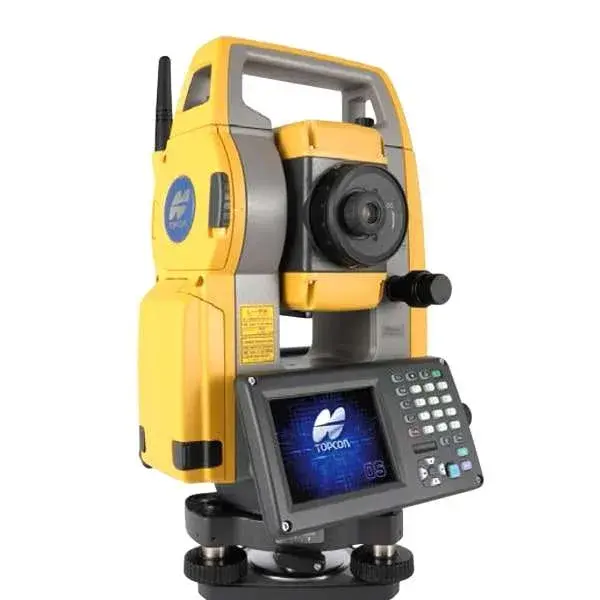
Manual total stations are the most common and the traditional total stations used in surveying industry. The surveyor has to look through the telescope, manually record the angle and distance readings, which the instrument then uses to calculate coordinates.
The biggest advantage of a manual total station is that it is affordable and easy. It requires very little training and is ideal for small-scale projects, students and surveyors working on a tight budget. The tradeoff is that fieldwork is slower than with robotic models, normally requiring two people (one at the instrument and one at the prism) and there is slightly more potential for human error in sighting.
Manual Total Stations We Offer
2. Robotic Total Stations
With robotic total stations, automation goes one step further, as the instrument can automatically track and follow the prism as it moves around the job site. That means a single surveyor can operate the entire setup by themselves, walking to each point with the prism pole, while the instrument adjusts and locks onto the target by itself, with no second person required at the eyepiece.
This automated tracking drastically reduces fieldwork time and the labor costs associated with a two-person survey crew, thus making robotic total stations the preferred option for large infrastructure projects, road construction, and firms with high survey volumes. The main consideration is the increased cost of the automatic models versus the manual models but most firms recover that cost through faster project turn-around and less need for staffing over time.
Robotic Total Stations We Offer
3. Reflectorless Total Stations
The idea behind reflectorless total stations is to measure distance from a surface directly using an infrared or laser signal without having to have a prism or reflector at the point of interest. They are therefore perfect for measuring points which are difficult, unsafe or physically impossible to reach with a prism pole – e.g. bridge girders, tunnel ceilings, building facades or unstable slopes.
Reflectorless total stations are commonly used in structural surveys, mining and infrastructure inspection work because they remove the requirement for a physical target. It is not practical to get directly to every point of measurement. Modern total stations, including robotic ones, now have a built-in reflectorless mode. This gives surveyors the flexibility to switch between prism and non-prism measurement depending on the site conditions.
Key Features to Look for in a Total Station
When choosing a Total Station, consider the following specifications:
- Angular Accuracy – Expressed in seconds (1”, 2”, 5” etc) – the lower the number the more accurate the measurement.
- Distance measurement range (prism and non-prism – some models up to 3,000m+)
- Battery Life – Fewer site interruptions with extended battery life.
- On-board software – Coordinate geometry (COGO), stakeout and resection functions
- Data Storage & Connectivity – USB, Bluetooth or Wi-Fi for ease of data transfer
- Durability – Dust and Water Resistant with an IP rating, needed for outdoor use
- Popular brands: Leica, Topcon, Sokkia, Trimble and Nikon.Brand Reliability
Applications of Total Station
Total stations are basic civil surveying tools used in a variety of industries, such as:
Land Surveying – Boundary mapping and topographic surveys in which a land survey total station helps to establish accurate property lines and elevation contours.
Construction Layout – Precision setting out of building foundations, columns and grid lines to millimetre accuracy before excavation.
Road & Highway Projects – Design of alignment, cross-sections and calculation of earthwork volume for large scale road construction.
Mining Surveys – Volume calculations for stockpiles and open pit sites, general site mapping.
Infrastructure Projects – Bridges, dams, pipelines, utility mapping, often requiring reflectorless measurement for hard to reach structural points.
This range of uses makes a total station often considered the most versatile item of ground survey equipment on a modern job site — capable of handling tasks that would otherwise require multiple separate instruments.
How to Use a Total Station: Step-by-Step
For anyone new to a total station survey, here’s a simplified field workflow:
- Set up the tripod over a known survey point and level the instrument using the built-in bubble level and electronic leveling sensor.
- Power on and set the station – enter the known coordinates of the instrument’s location (backsight/orientation point).
- Orient the instrument by sighting a known reference point (backsight) to establish direction.
- Select measurement mode – angle-only, distance-only, or coordinate (X, Y, Z) capture.
- Sight the target – point at the prism or use reflectorless mode for the point being measured.
- Capture and store the reading – the instrument automatically logs angle, distance, and elevation data.
- Repeat for all points, then transfer the stored data to survey software for processing, mapping, or design.
Following a consistent setup and calibration routine each time you use this land survey total station equipment significantly reduces errors in the final dataset.
Total Station Calibration Guide
Regular calibration keeps your total station performing to the accuracy for which it is rated. Even small mechanical shocks in transport can cause errors that are not obvious until you compare results to a known control point. Here is a simple guide on how to keep your land surveying equipment running well.
When to Calibrate
- Before starting any high-precision project (construction layout, boundary work)
- After the instrument has been dropped, jolted, or transported over rough terrain
- At least once every 6–12 months as routine maintenance
- If field results show unexplained inconsistencies against known control points
Basic Field Checks
- Vertical Index Error Check – Measure a vertical angle in both face-left and face-right positions. The average should match; a consistent difference indicates index error that needs correction.
- Collimation (Line of Sight) Check – Sight a fixed target in both telescope faces and compare horizontal angle readings to detect any misalignment in the crosshairs.
- Horizontal Circle Check – Measure the same angle from different starting positions on the circle to rule out graduation errors.
- EDM Accuracy Check – Measure a known baseline distance (ideally certified) and compare it to the instrument’s reading to confirm distance accuracy.
- Tribrach and Optical Plummet Check – Ensure the instrument is centering correctly over the survey point, as a small plummet error can throw off every reading taken from that setup.
Field Adjustment vs Professional Calibration
Most modern total stations have a built-in calibration menu that enables frequent on-site correction of small index and collimation errors. If you need EDM accuracy, tribrach wear or persistent angular errors, however, sending the instrument to an authorized service center or the manufacturer (Leica, Topcon, Trimble, Sokkia, Nikon) for professional calibration with certified equipment is best.
A simple calibration log, recording the date, checks performed and any corrections made, should be kept by any firm undertaking a total station survey for legal or high stakes construction work.
Total Station Price in India
Total station price and total station cost depend heavily on brand, accuracy class, range, and features (manual vs robotic vs reflectorless).
Note: These figures are indicative and can vary based on the dealer, brand (Leica, Topcon, Trimble, Sokkia, Nikon), warranty terms, and after-sales support. It’s always advisable to get a direct quote and compare specifications like angular accuracy and EDM range before finalizing a purchase, since two models at a similar price point can differ significantly in performance.
Popular Total Station Brands
- Topcon – Offers a strong balance of reliability and price, widely used in construction and road projects.
- Leica – Known for high-end robotic total stations with industry-leading accuracy, popular among large infrastructure firms.
- Sokkia – A trusted, budget-friendly option for general land surveying and construction layout work; see our detailed guide on the Sokkia Auto Level as well.
- Trimble – Popular for GNSS integration and robotic models suited to large-scale infrastructure.
- Nikon – Known for durable, easy-to-use entry and mid-range total stations, good for smaller survey firms.
Maintenance Tips & Common Mistakes to Avoid
To keep your land surveying equipment performing accurately over time:
- Calibrate regularly – Angular and EDM accuracy should be checked periodically, especially after transport or a hard knock.
- Protect from moisture and dust – Even IP-rated models should be stored in a proper case when not in use.
- Avoid direct sunlight on the lens for extended periods, as this can affect internal components over time.
- Charge batteries fully before fieldwork to avoid mid-survey data loss.
- Double-check backsight orientation at the start of every session — a common mistake that leads to systematic errors across an entire dataset.
- Avoid rough handling during transport – always use the original padded case, even for short-distance moves on site.
Total Station vs Other Land Surveying Equipment
One of the most common questions from students and professionals entering the field is how a total station compares to other equipment for land surveying. Here’s a quick breakdown.
Total Station vs Theodolite
Feature | Total Station | Theodolite |
Distance measurement | Built-in EDM, automatic | Requires separate tape/chain |
Data storage | Digital, internal memory | Manual recording |
Coordinate calculation | Automatic (X, Y, Z) | Manual calculation needed |
Accuracy | Higher, less human error | Depends on operator skill |
Cost | Higher | Lower |
Best for | Modern construction, large projects | Basic angle measurement, small budgets |
A theodolite only measures angles — a surveyor still needs a separate method to measure distance. A total station eliminates this extra step, which is why it has become the standard ground survey equipment on most sites today.
Total Station vs GPS/GNSS Survey Equipment
Feature | Total Station | GPS/GNSS |
Accuracy | Millimeter-level, ideal for short range | Centimeter-level, better for large/open areas |
Line of sight required | Yes | No |
Works indoors/urban canyons | Yes | Often unreliable |
Speed for large area coverage | Slower | Faster |
Cost | Moderate to high | High (RTK setups) |
In practice, many survey firms use both — GPS/GNSS for large open-area control points, and a total station for detailed, high-accuracy work like construction layout, boundary points, and areas with obstructed sky view (basements, tunnels, dense urban sites).
Total Station vs Auto Level / Digital Level
While an Auto Level or Digital Level is excellent for measuring elevation differences (leveling work), it cannot measure horizontal angles or distances the way a total station can. Auto levels remain popular as affordable civil survey equipment for basic leveling tasks, but for full 3D positioning, a total station is required.
Total Station FAQ
Boundary mapping, construction layout and topographic surveys are done using a total station to determine the horizontal and vertical angles, distances and elevation to determine the exact X, Y, Z coordinates.
For construction layout work mid-range to robotic total stations from Leica, Topcon or Trimble are generally preferred. These offer higher accuracy and faster single-operator workflows.
Typical surveying equipment includes a total station, prisms/reflectors, tripods, GPS/GNSS receivers (for large area control), auto levels (for elevation checks), and survey software (to process data).robotic models such as the MS series.
It all depends on the application. For shorter distances and areas with obstructed sky view, a total station is more accurate, but GPS/GNSS is faster for large, open areas.
Modern total stations are typically accurate to between 1" and 5" for angles and a few mm for distance measurement, depending on the model and conditions.
Yes, reflectorless total stations can take measurements off a surface directly without a prism, which is useful if the point is hazardous or difficult to get to.
Conclusion
A total station is still one of the most important civil survey instruments today, combining angle measurement, distance measurement and data processing into one reliable instrument. The total station continues to stand out for its accuracy, versatility and efficiency in land surveying, construction, road and infrastructure projects whether it is being compared against a theodolite, GPS/GNSS system or auto level.
When considering equipment for land surveying for your next project, knowing your accuracy needs, your budget and site conditions will help you determine if a manual, robotic or reflectorless total station is right for you — and get the most out of your investment.