

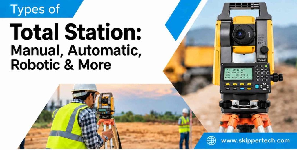
The total station is the most widely used surveying instrument in modern construction, engineering and measuring the land. It integrates electronic angle measurement, distance measurement, calculation of coordinates and digital data collection in one instrument. This combination allows surveyors to perform a wide range of field tasks faster and with better data management than many traditional surveying methods.
Surveying technology has progressed from traditional manually operated instruments to highly automated and robotic systems; the total station has evolved. Today there are various models for varying applications from basic construction layout and land measurement to high precision engineering surveys, monitoring, infrastructure development and advanced digital workflows.
When selecting the right type of total station, you have to look beyond accuracy or measurement range. Also, surveyors and project managers should consider automation, software, target recognition, reflectorless measurement, data communication, environmental conditions, field productivity, and after sales technical support.
Understanding the types of total stations assist professionals in selecting an instrument that satisfies their real project needs.
What is a Total Station ?
Total station is an electronic optical surveying instrument for measuring horizontal angles, vertical angles and distances. The instrument combines these observations with onboard computation to determine coordinates and positions of points.
Traditional surveying has generally used different instruments for different tasks. A theodolite is a common instrument for measuring horizontal and vertical angles. Other equipment may be needed to measure distance. In a modern total station all these functions are integrated, making the field workflow more efficient.
A typical total station consists of several important parts. These include a telescope, electronic angle sensors, electronic distance measurement (EDM) system, processor, display, keypad or touchscreen, battery and internal or external data storage.
Depending on the model, the instrument may also feature reflectorless measurement, automatic target recognition, motorized movement, wireless communication, onboard survey software and imaging capabilities.
On a normal survey the instrument is mounted on a tripod and carefully centered and leveled over a known survey point. Once the instrument is set up and aligned , the surveyor sights a prism or target and makes measurements . The data collected can then be used for coordinate computations, mapping, construction layout, stakeout, area computations and other surveying operations.
Main Types of Total Station
The names of products may vary from manufacturer to manufacturer . However , in general , total stations can be categorized into different types based on their method of operation , degree of automation and measurement capabilities .
The most common types are manual or conventional total stations, automatic or motorized total stations, robotic total stations, reflectorless total stations, prism-based systems, imaging total stations and compact models.
Some modern instruments combine several of these technologies into a single unit. For instance, a robotic total station might also have reflectorless measurement and imaging functions.
Manual or Conventional Total Station
The surveyor directly operates a manual or conventional total station. The operator moves the instrument horizontally and vertically by hand, sights the object through the telescope and makes the necessary measurements.
The reason this type of instrument is popular is that it offers the essential capabilities required for many surveying tasks without the need for a lot of automation.
A typical total station can measure horizontal and vertical angles, calculate distances, calculate coordinates, store observations and help with common surveying tasks such as stakeout and resection.
Many models also offer reflectorless measurement, which allows the operator to measure certain surfaces without having to place a prism directly on the target.
Manual total stations are widely used in construction, road projects, property surveys, topographic work, utility surveys and general land surveying applications.
For the experienced surveyor, manual operation may offer a direct control of the instrument and of the measurement process. It can also be suitable for smaller projects where the extra automation of the robotic system might not be required.
Automatic or Motorized Total Station
Automatic or motorized total stations add power to move the instrument. The instrument is motorized so it moves horizontally and vertically, rather than you having to turn the telescope for each target.
Depending on the model, automation can include automatic target recognition, target searching, auto-pointing and prism locking.
These functions can reduce repeated manual operations and accelerate point collection. Rather than manually turning the instrument to each target, the surveyor can use the instrument’s automated functions to assist in acquiring and positioning on the target.
Motorized systems are often useful on larger construction sites where many points need to be measured or set out throughout the day.
Possible applications are building layout, infrastructure construction, road projects, repetitive measurement tasks, monitoring, large area survey operations.
But motorized doesn’t mean fully robotic. Some motorized total stations still require the surveyor to be close to the instrument and manually operate the system through the instrument interface.
Robotic Total Station
The robotic total station is a higher level of automation, designed to minimize the amount of physical interaction at the instrument.
The instruments combine motorized motion with technologies such as automatic target recognition and prism tracking. Often the surveyor can take the prism around the site and remotely control the instrument using a field controller.
This can enable a single operator to execute duties that normally took two people.
In a traditional workflow, one person is at the total station and another person is holding the prism. The surveyor walks around with the prism and controller, and the instrument will automatically track the target with a robotic system.
The standard workflow for a robot starts with the installation and correct leveling of the instrument over the desired survey point. After establishing orientation and identifying the prism, the surveyor activates the tracking function and walks around the site to different points. The instrument stays in contact with the prism within its defined operating limits. This allows for remote measurements and staking out.
Major advantages are less manpower, faster field operations, easier stakeout, and less time going back to the instrument.
Robotic total stations are especially helpful for construction layout, high-rise buildings, infrastructure projects, structural work, detailed site measurements, monitoring and projects that require frequent point positioning.
Reflectorless Total Station
The reflectorless total station can measure distances to suitable target surfaces without a prism.
Rather than measure against a prism, the instrument sends a measurement signal to a surface and calculates the distance based on the signal it receives back. This is very useful when the target is out of reach or unsafe to reach.
For example, a surveyor may need to measure a building facade, the face of a wall or rock face, a road cutting, a structural element or other hard to get to feature.
Reflectorless measurement can do away with the need to physically place a prism at every point and can improve productivity in some applications.
However, reflectorless performance is a function of the target surface, distance to target, environmental conditions, angle of incidence, and instrument specifications. Dark, shiny, transparent or irregular surfaces may not behave as suitable solid targets.
For higher confidence measurements, especially where precision is critical, surveyors must know the recommended operating conditions of the instrument and use prism-based measurements where appropriate.
Prism-Based Total Station
Prisms are measured as a basic part of professional surveying.
To do this, a prism is placed at the point to be measured. The total station sends the EDM signal to the prism and measures the distance from the instrument to the target.
Prism measurements are widely used when reliable long range measurement and consistent target identification are important.
They are often used in construction layout, control surveys, road surveys, property surveys, engineering measurements and other detailed site work.
Many modern instruments can be used in prism mode and reflectorless mode. This enables surveyors to choose the most suitable measurement method depending on a target’s location and characteristics.
Imaging Total Station
Imaging total stations extend the capabilities of traditional surveying with camera-based functions.
Depending on the model, built-in cameras can help with target identification, documentation, visual guidance and advanced workflows in the field.
Adding imaging technology is especially helpful when surveyors want to connect measurement data to visual information of the site.
For instance, surveyors may collect coordinate data of the terrain and physical features during a detailed topographic survey, using imagery to provide additional visual context.
Imaging technology can also assist with construction documentation, structural inspection workflows, site records and visual verification of measured areas.
Capabilities differ greatly among manufacturers, so users should consider actual camera resolution, image functions, software integration and available field features rather than assume that all imaging total stations provide the same functionality.
Compact Total Station
Compact total stations are made with portability and ease of transportation in mind.
A smaller, lighter instrument can be helpful when surveyors frequently move from place to place or work in areas where access is tricky.
Compact instruments are ideal for building surveys, interior measurements, architectural work, smaller construction projects and general field applications.
But the same important criteria should be applied to a compact instrument as to a larger instrument. Practical performance may be affected by accuracy, distance range, environmental protection, software, battery capacity, data connectivity and service support.
The size of the instrument itself should not be a reason to purchase it.
How Total Station Technology Has Evolved
The total station’s evolution is a microcosm of the surveying industry’s wider digital transformation.
Previous survey procedures depended on manual observation, hand-written field notes, and independent calculations. Modern total stations can automatically take observations, calculate, transfer the data digitally and interface with other technologies.
Automation has impacted the role of the surveyor. Professionals are able to spend more time controlling the survey workflow, checking data quality, managing coordinates and linking field measurements to design information, rather than spending a lot of time physically operating the instrument.
Advanced instrumentation can allow functions such as:
- Automatic target identification
- prizm tracking
- Powered positioning
- Wireless control
- Measurement without reflector
- Digital stakeout
- Data transmission
- Imaging Field software integration
This has widened the scope of industries that can take advantage of total stations.
Total Station for Construction and Land Surveying
Total stations play an important role in construction and land surveying, because they can provide measurements and coordinate-based positioning.
It can be used in construction sites for building grid setting, foundation point location, column positioning, design coordinate transfer, alignment checking and as built measurement.
This instrument can be used for road and infrastructure projects including centerline layout, alignment checks, cross section data collection, positioning of drainage and other survey requirements.
In property surveying, total stations can assist surveyors in measuring boundary points, establishing control networks and collecting information required for maps and plans.
In a topographic survey, surveyors can acquire points that represent physical features and ground elevations. Later these observations can be processed into contour lines, digital terrain models, site plans and engineering drawings.
The total station itself is not the be-all and end-all of survey quality. The accuracy of the final output is a function of many factors, such as quality of control points, accuracy of the set up, field procedures, calibration, atmospheric conditions, target positioning, and technical experience of the surveyor.
Total Station Vs Other Surveying Instruments
Rarely is one instrument used for all surveying project tasks.
For example, an auto level is mainly used for setting up and transferring elevations. It is useful for benchmarks, foundation levels, slab levels, road formation levels, drainage work and other applications where accurate height differences are important.
One example is the Sokkia auto level , which can be a great option for traditional leveling workflows where elevation measurement is the primary need.
More detailed measurements use a total station to integrate angles and distances with coordinate computations. This is suitable for placing points in two and three dimensions.
The difference also counts when comparing total station and theodolite. Theodolites measure horizontal and vertical angles. Total stations measure distance electronically and process coordinates digitally.
This does not render a theodolite useless. There are situations where angle measurement is the main requirement. However, if a project requires distance measurement, coordinates, digital storage and layout functions in one instrument, a total station can allow for a more integrated workflow.
Factors to Consider Before Buying a Total Station
The choice of surveying equipment should start with the real needs in the field.
Accuracy Requirements
The accuracy of the angle and distance needed should be specified based on the project.
Construction layout, topographic surveys, monitoring, industrial measurement and precision engineering applications may require different levels of accuracy.
While selecting an instrument with much higher specifications than necessary might not always provide practical benefits if the rest of the workflow does not require that level of accuracy.
Measurement Range
– Check the instrument’s specified prism and reflectorless ranges.
Actual range performance may vary depending on weather conditions, visibility, surface conditions, target size and measurement mode.
Automation Level
Determine if the project requires conventional operation, motorized movement, automatic target recognition or robotic tracking.
Manual handling of routine projects. If you have a lot of work to do or a project that really benefits from being able to be operated by one person, you might find that having robotic functionality can improve your workflow .
Software & Data Management
Modern surveying is very much about software.
Before buying a total station, check if it can support the required functions, file formats, controllers, CAD workflows and data transfer methods.
Functions can be useful like:
- Monitoring
- Surgical excision Go through
- Geometry Coordinate
- Measurement of offset
- Calculate area
- Height measurement
- point-code
- Import and export of data
Battery life
Battery performance can impact field productivity.
For longer work hours, spare batteries or higher capacity power options may be required for projects.
Environmental Protection
Survey instruments on construction sites can be subject to dust, moisture, vibration, high temperature and other harsh conditions.
This means that the environmental specifications must be carefully considered in making equipment selections for demanding field environments.”
Connectivity
In modern workflows there is often a need for communication between the total station, the controller, the office PC and the survey software.
Connectivity might be Bluetooth, Wi-Fi, USB or other communication interfaces depending on the instrument.
Technical Support and Service
Post sales support is an important factor that is often overlooked.
A surveying instrument is a precision device that may need calibrating, inspecting, servicing, software updates, technical assistance and spare parts throughout its life.
Availability of trained service engineers and local support can directly impact equipment uptime and productivity of the project.
Common Mistakes in Choosing a Total Station
A very common mistake is selecting an instrument based on maximum distance only.
Another is to take it for granted that the highest accuracy specification is the best for every project.
Surveyors should consider the practical use of the instrument. A construction company that does a lot of layout work might be more interested in basic stakeout functions and automation. For detailed mapping, a survey firm might concentrate on data management, accuracy, reflectorless performance, and software compatibility. Robotic tracking and remote operation could be beneficial to a major infrastructure project.
Experience of the survey team is also important to consider. “Advanced features are only useful if the operators know how to use them properly.
Training, calibration, technical service and maintenance should therefore be considered as part of the equipment investment.
The Future of Survey Using Total Station
The future of total station technology will be heavily linked to automation, digital workflows, imaging, cloud-based data management and integration with other positioning technologies.
Surveyors are increasingly relying on digital drawings, 3D models, GNSS receivers, CAD platforms, GIS systems, and construction management software. This connected ecosystem is absorbing the total stations.
Ongoing advances in robotic tracking and automated target recognition could reduce repetitive field operations even more. Imaging tools can also offer supplementary visual context for measurements and documentation.
At the same time, the demand for skilled survey professionals remains strong. Technology can do a lot of things, but good surveying still requires correct setup, control, methods of observation, data checks and professional judgment.
Conclusion
There are many different kinds of total stations, each designed to support different surveying requirements.
Manual or conventional total stations have basic angle and distance measurement controlled directly by the operator. Automatic and motorized instruments provide target-related automation and powered movement. Robotic systems enable greater automation via remote operation and prism tracking. Reflectorless instruments offer extra flexibility for imaging inaccessible targets, and compact models meet particular workflow and portability requirements.
Construction, land surveying, infrastructure, mapping, and detailed topographic survey require the right instrument depending on the accuracy requirements, range, field conditions, manpower, software requirements, and the level of automation needed.
It is also good to know the working of a total station with other instruments. An auto level is still useful for elevation work and a theodolite is still good for angle measurement applications. More advanced projects may use traditional survey equipment, along with GNSS and a robotic total station for a more complete field workflow.
In the end, the decision of which total station to use should be based on the practical needs of a project, not simply on choosing the instrument with the most features. Accuracy, reliability, software, connectivity, durability, service support and operator training all contribute to the long-term value of the equipment.
When taken together, these factors make a good total station a key component of an efficient and accurate modern surveying workflow.